Children create a map of a city, a farm, or a carnival.
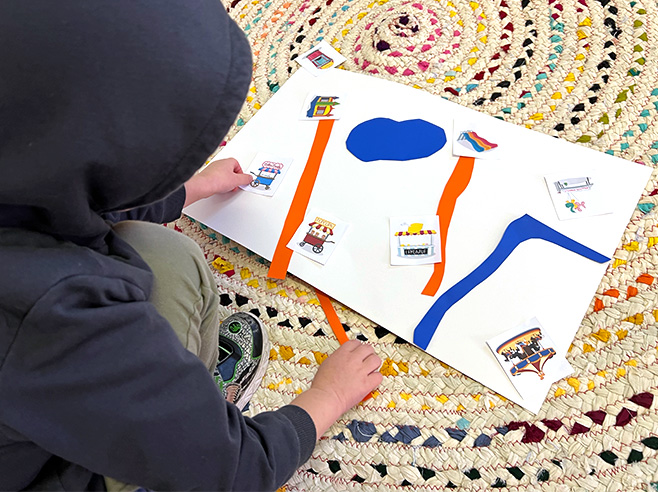
Children make a map on the floor using cutouts of different landmarks.
Materials
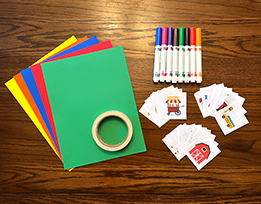
- Make Your Own Map: Landmark Cards (PDF)
- Crayons or markers
- Construction paper
- Masking tape
- Scissors
- Camera (can use iPad camera)
Preparation
- Print out multiple copies of the Landmark Cards (PDF), cut out the pieces, and laminate, if possible
- With masking tape, create one or more large rectangular outlines on the floor (2 X 3 feet). This is the outline of the map. You may want to have more than one outline, depending on how many children are in the group.
- Supply construction paper and scissors so children can create additional cutouts (roads or pathways, extra buildings, etc.), if they want.
Directions
- Tell children they will work together to create a map of a farm, city, or carnival. Ask them to choose one of the three map themes. (If children want to combine two of the themes, e.g., city and carnival, that’s also an option.)
- Before handing out the cutouts, ask them to name some landmarks that they might find on their map.
- Show them the outline of their map on the floor and hand out the cutouts.
- If there are other landmarks they’d like to add to their map, they can draw them on the paper and cut them out. (You might suggest adding roads or a path by cutting out strips of paper.)
- When finished, have children describe where they put the landmarks on their maps, using spatial language.
- Take a photo of their map when finished so they can view it later. Have them put away the landmarks for the next group.