Reread Henry’s Map and have children “walk the map” around the classroom.
Materials

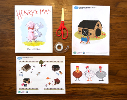
- Henry’s Map by David Eliot
- Children’s Farm Maps from the Follow Henry’s Map activity
- Make a Walkable Map (PDF). Note: Because of copyright considerations, the images used in the activity differ from those in the book.
- 5 chairs
- Tape
- Scissors
Preparation
- Note: This activity should follow the two others based on Henry’s Map (Henry’s Map Read Aloud and Follow Henry’s Map)
- Print out the Make a Walkable Map: it includes 5 landmarks and 5 animals.
- Cut out the 5 animal pictures.
- Arrange 5 chairs in a large semicircle near where you have Circle Time. Have the backs of the chairs facing you and your class. As you read the book, children will tape the landmarks and animal pictures to the chairs, creating a “walkable map” of the farm. Then children will take a walk around the farm just as Henry does.
Directions
- Have the book and set of Walkable Map landmarks and animals in front of you. Stack children’s Farm Maps (from the previous activity, Follow Henry’s Map) in a pile nearby.
- Tell children that together you’re going to create a map like Henry’s, with the same landmarks. It will be a “walkable map.” Children will be able to walk from one landmark to another!
- Demonstrate what you mean by picking up the first landmark (#1 Pig Sty) and taping it to the first chair. Say: This is the first landmark on our map, the pig sty — just like on Henry’s map! Point out the landmark on Henry’s map in the book.
- Read until you get to the next landmark, the woolshed. Hand a volunteer that landmark (#2 Woolshed), adding a piece of tape to the top of the sheet, and have them tape the landmark to the second chair. Pointing to Henry’s map in the book, say, First comes Henry’s sty, then when we walk farther, we reach the woolshed.
- Continue reading, pausing at landmarks, and having volunteers tape the landmarks pictures to the chairs, continuing until all five have been taped.
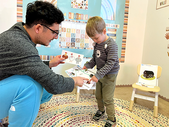
- Then pass out each child’s Farm Map. Have them locate each landmark on their maps and each landmark taped to the chairs, to make sure they understand their maps and the Walkable Map correspond.
- Start reading again: Now the animals are up on the hill and notice that there are no animals down on the farm. Ask children why the animals are upset. (They see the animals on the map. But when they look at the farm, they don’t see any animals). Then ask them to look around at the landmarks you’ve taped and ask whether something is missing. There are no animals on your “farm!” either!
- Continue reading. Henry “rushed to the chicken coop, staring at his map. There should be hens right here.” Hold up the animal picture with the 3 hens. Ask the class where the chicken coop landmark is in the classroom. Hand a volunteer the picture of 3 hens with a piece of tape on top and have them tape the animals next to (or below) the chicken coop landmark picture.
- As you continue reading, have volunteers tape the animal drawings near their corresponding landmark.
- When you finish the story, have children walk the map in groups of two or three, holding their maps and describing to each other each landmark and the animals they come to. (Children who did not have a chance to tape landmarks or animals to the chairs should take the lead).
